Torok Waterfalls Near Iten
| Distance from Nairobi | About 330km |
| Starting Point | Junction on Iten-Kabarnet Rd |
| Ending point | Junction on Iten-Kabarnet Rd |
| Walking Duration | 4-5 hours |
| Terrain | Dirt road |
| Difficulty | Moderate |

Iten has become a place of pilgrimage for world-class athletes from all over the world, looking to improve their athletics performance in the place that keeps producing the highest number of world record holders. Situated at 2,400m above sea level, it is home to Lorna Kiplagat’s High Altitude Training Centre (HATC), the first facility of its kind setup specifically to nurture athleticism, and give visitors a sneak peek into the daily lives and routines of Kenya’s World Champions.
There is more to Iten than athletics training and brushing shoulders with world-class athletes. It is endowed with numerous excellent viewpoints down into Kerio Valley, due to its location on the edge of the escarpment. For the more adventurous, the Torok waterfalls cascading down the escarpment to join the Kerio River, offers a great hiking opportunity, and a chance to meet and interact with the local Keiyo community along the way.
Route Description
The dirt track from the Iten – Kabarnet Rd cuts through farms as it heads to Torok waterfalls in a southbound direction.
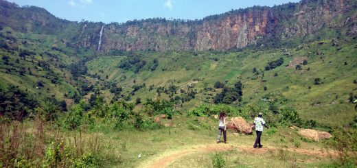
The dramatic escarpment wall dominates the view ahead of you, stretching for kilometers to the left and right. Its kaleidoscope of colours is stunning, with the green hues of nascent forest cover racing to conquer the plunging red and grey rock faces of the escarpment. In the middle of this view, the thin silver line of the Torok waterfalls holds its own as it cascades down the escarpment, enticing you to get closer with the promise of a fine spray and possibly a dip if you are so inclined.
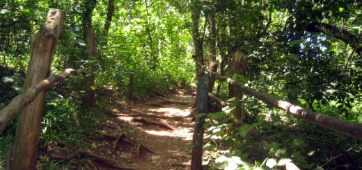
Along the way, you encounter a couple of river crossings, and some steep sections as you climb out of the river valleys. The sharp inclines of the slopes covered with maize make you wonder at the locals’ capacity to scale and toil on these steep gradients. Sadly, the farmers have not created terraces to check soil erosion during heavy rains.

The walking distance from the Iten-Kabarnet Rd junction is about 7km, so the round trip is about 14km, and should take you about 4-5hours of hiking.
Getting There
If using public means from Nairobi, take Eldoret buses from Machakos country bus station, or shuttles from their stage off Haile Selassie Rd near the Nairobi Railway Station. From Eldoret, take Iten matatus,. At Iten town, you’ll find plenty of accommodation options. The next day, get Kabarnet matatus from Iten and alight at the junction to Torok Primary School, about 17km from Iten.
If driving from Nairobi, use Nakuru Road on the upper escarpment, and drive past Nakuru to Eldoret. Turn right onto the Iten Rd and drive for about 35km to Iten. The total distance of this route is about 410km. Alternatively, from Nakuru branch off to the right onto the road to Marigat. At Marigat, turn left onto the road to Kabarnet. Follow this road past Kabarnet upto Iten. This route is about 347km from Nairobi.
From Iten, take the Kabarnet Rd and drive for about 17km till you see a signpost on your right for Torok Primary School. Turn onto this dirt road and find a spot to park. In case you find yourself at the Kolol viewpoint, you’ve gone too far. Turn back and drive for about 1km to the Torok School turnoff.
The total distance from Nairobi through Eldoret, to this hike starting point is about 430km. There is an alternative route from Nairobi through Marigat and Kabarnet, with a total distance of 347km to Iten. You’ll then drive back 17km from Iten to the hike starting point, assuming you’ll need to do this the following day.
Guide
Mathew – +254 799 464315

